
|
|
Home | |
|
Severe Tropical Storm Helen I can't remember when I started doing the 'business'. But S.T.S. Helen in mid-August of 1995 was surely impressive for me. She followed a typical storm track, in which the storm adopted a west-northwesterly track, then turned increasingly northward towards the southern coast of China. Although Helen wasn't a strong typhoon, she did hit Hong Kong with full strength for its close proximity to the territory. Normally, we consider 'direct hit' as having a closest point of approach (CPA) of less than 100 km. Helen was such a case to Hong Kong. |
|
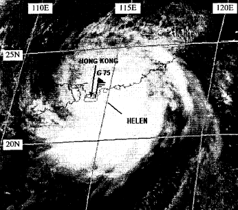 Fig. - A satellite image of Helen at its peak intensity. |
 Fig. - A newspaper cutting on the day Helen affected Hong Kong. From Appledaily. |
|
Typhoon Victor Typhoon Victor had the same name as I, but I can tell you that I have had my name long before the 'birth' of the storm on 1/8/97. That year was an El Nino year, and the number of storms affecting Hong Kong was smaller than that in normal year. Despite this, Victor was able to give an exciting season for us. He gave a really direct hit to Hong Kong, passing over the Tsing Ma Bridge and landing at Tsuen Wan. But as the storm weakened significantly before landing, wind didn't reach hurricane level (> 118 km/h). |
|
 Fig. - A view of Victor before it came further closer to Hong Kong. |
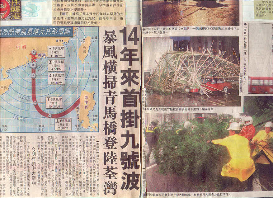 Fig. - A newspaper report during the passage of Victor. From Oriental Daily. |
|
Typhoon Sam The year 1999 was just opposite to 1997. A number of typhoons affected Hong Kong, among which five gave direct hits to Hong Kong. Typhoons Sam and York were two of them. Sam came as straightly as possible towards Hong Kong. He came quickly, but went away slowly. Wind didn't subside and rain didn't stop for several days. However, the air-traffic couldn't delay for days. The weather condition was so poor that a plane accident happened. It turned completely over and there were several fatalities... |
||
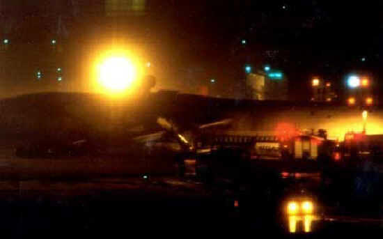 Fig. - A plane turned over in Chek Lap Kok International Airport under poor weather condition. From Sing Tao Daily. |
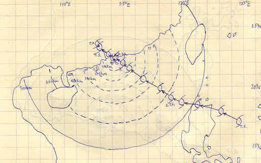 Fig. - My plot of the track of Sam, showing how 'straight' it was heading at the territory. |
|
|
Typhoon York Hurricane wind hadn't been blowing over Hong Kong since Typhoon Ellen in 1983. But York in 1999 did it. It has also broken the record of longest duration of hurricane wind in the territory. I would say that morning I witnessed the strongest wind I'd ever experienced. Winds were roaring and trees were torn up by the roots. Nevertheless, York was not particularly powerful, with maximum sustained wind of no more than 150 km/h. |
|
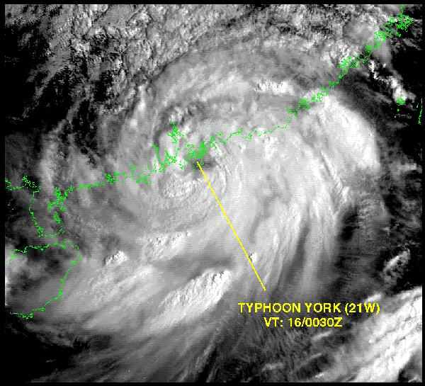 Fig. - Typhoon York over Hong Kong. |
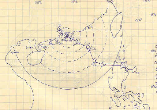 Fig. - My plot of the track of York. |
|
Typhoon Utor Typhoon Utor was a recent storm in 2001. He had made huge destructions in Taiwan and the Philippines before entering the SCS. Utor moved rather rapidly, born down menacingly. I still remember the evening that Utor approaching Hong Kong. The sky was yellow , the air was still, and the scene was strange. After that, winds started to pick up and gale winds blew for a day. Unfortunately, that day was the announcement day of the A-level exam results! Candidates therefore had to check their results via the net, but it took me hours to access the website! I'm sure students of my year can't forget this 'special' experience! |
||
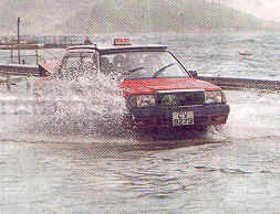 Fig. - Look! Sea water moved 'inland' because of the storm surge - difficult to distinguish land and sea! |
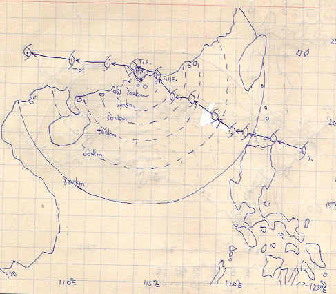 Fig. - My plot of the track of Utor. |
|